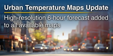
meteoblue and Sixense Helimap: Swiss Precision in Geospatial Data
This partnership integrates high-resolution weather forecasts with advanced terrain mapping techniques to improve decision-making in complex environments.
|
|||||||||
---|---|---|---|---|---|---|---|---|---|
Icon
|
|
|
|
|
|
|
|
|
|
Temperature (°F)
|
|||||||||
Temperature felt (°F)
|
49° |
48° |
51° |
54° |
52° |
51° |
52° |
54° |
|
Wind direction
|
WSW |
SW |
SW |
SW |
SW |
SW |
WSW |
WSW |
|
Wind speed (mph)
|
WSW
11-20
11-20
|
SW
12-20
12-20
|
SW
16-28
16-28
|
SW
18-31
18-31
|
SW
21-38
21-38
|
SW
20-37
20-37
|
WSW
18-32
18-32
|
WSW
15-26
15-26
|
|
Precipitation (in/3h)
|
-
0%
-
|
-
0%
-
|
-
25%
-
|
-
25%
-
|
-
40%
-
|
-
55%
-
|
< 0.04 in
65%
< 0.04
|
-
35%
-
|
|
Precipitation probability
|
0%
|
0%
|
25%
|
25%
|
40%
|
55%
|
65%
|
35%
|
|
Precipitation hourly
|
|||||||||
rainSPOT
Precipitation distribution within 20 km
|
|
Sea/surf forecast | ||||||||
Significant wave height (m)
|
||||||||
---|---|---|---|---|---|---|---|---|
Significant wave direction in which the waves move
|
||||||||
Water temperature (°F)
|
59° |
59° |
59° |
59° |
58° |
58° |
57° |
57° |
Overnight into Friday it is mostly cloudy. And in the morning even more clouds will move in. Friday afternoon it will be cloudy and rainy. The sun will not be visible. With 60% probability of precipitation we are at the upper end of a moderate chance. Temperature highs are likely to reach 64 °F. Overnight into Friday a gentle breeze is expected (8 to 12 mph). At the break of day expect a moderate breeze (12 to 18 mph). Friday afternoon blows a fresh breeze (18 to 25 mph). From time to time gusts could reach up to 38 mph. Winds blowing from Southwest. The weather forecast for Drogheda for Friday can be accurate in parts but deviations are expected. Check again for latest updates.
Pressure: 1020 hPa
Timezone: IST (UTC +01:00h)
High wind speeds expected for Drogheda. More Weather Maps
The animation shows the wind conditions of the storm at 200m above ground, which corresponds well with expected gusts at the surface. Choose other time steps to see the forecast of the storm.
The real-time satellite image combines visible light during daytime with infrared radiation during nighttime. At night, the image is not dark as infrared radiation can detect temperature differences. Unfortunately, low clouds and fog are difficult to distinguish from ground temperatures and thus can be almost invisible during the night. Meteosat satellite images for Europe are updated in real-time every 5 minutes. GOES-16/GOES-17 (North & South America) and Himawari (Asia) images update every 10 minutes.
Precipitation is estimated from radar and satellites. Precipitation estimates from satellites are less accurate at night than during daytime.
© 2025 meteoblue, NOAA Satellites GOES-16 and EUMETSAT. Lightning data provided by nowcast.
The location marker is placed on Drogheda. This animation shows the precipitation radar for the selected time range, as well as a 2h forecast. Orange crosses indicate lightning. Data provided by nowcast.de (available in USA, Europe, Australia). Drizzle or light snow fall might be invisible for the radar. Precipitation intensity is colour coded, ranging from turquoise to red.
Advertising is essential to maintain our free website with unique detail and accuracy.
Please whitelist www.meteoblue.com on your ad blocker or consider buying one of our products:
Already have a subscription?
Then please login.