
From Water Sports to Wine Tasting: meteoblue Day 2025
At the beginning of July, the meteoblue team gathered for the annual meteoblue day – an offsite filled with nature, laughter and a healthy dose of team spirit.


At the beginning of July, the meteoblue team gathered for the annual meteoblue day – an offsite filled with nature, laughter and a healthy dose of team spirit.
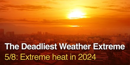
Record-breaking heatwaves in 2024 pushed heat stress to unprecedented global levels.
|
|
|||||||||
|---|---|---|---|---|---|---|---|---|---|
|
Icon
|

|

|

|

|

|

|

|

|
|
|
Temperature (°F)
|
|||||||||
|
Temperature felt (°F)
|
77° |
76° |
78° |
82° |
85° |
81° |
79° |
78° |
|
|
Wind direction
|
E |
E |
E |
WSW |
SSW |
W |
ENE |
E |
|
|
Wind speed (mph)
|
E
3-8
3-8
|
E
4-6
4-6
|
E
3-3
3-3
|
WSW
3-6
3-6
|
SSW
4-9
4-9
|
W
5-11
5-11
|
ENE
5-10
5-10
|
E
3-7
3-7
|
|
|
Precipitation (in/3h)
|
-
0%
-
|
-
0%
-
|
-
0%
-
|
-
0%
-
|
-
0%
-
|
-
0%
-
|
-
0%
-
|
-
0%
-
|
|
|
Precipitation probability
|
0%
|
0%
|
0%
|
0%
|
0%
|
0%
|
0%
|
0%
|
|
|
Precipitation hourly
|
|||||||||
|
Precipitation hourly
|
No precipitation expected |
||||||||
|
rainSPOT
Precipitation distribution within 20 km
|
|
||||||||
| Sea/surf forecast | ||||||||
|
Significant wave height (m)
|
||||||||
|---|---|---|---|---|---|---|---|---|
|
Significant wave direction in which the waves move
|
||||||||
|
Water temperature (°F)
|
75° |
74° |
74° |
74° |
74° |
75° |
75° |
74° |
The night and the afternoon clear skies prevail. Wednesday morning a few clouds are expected. It is a sunny day. Temperatures peaking at 76 °F. With a UV-Index as high as 10 make sure to properly protect your skin. Night and day blows a light breeze (4 to 8 mph). Winds blowing at night and in the morning from East and during the afternoon from Southwest. The weather forecast for Puerto Rico for Wednesday is expected to be very accurate.
Pressure: 1015 hPa
Timezone: WEST (UTC +01:00h)
By comparing today's temperatures to 40 years of historical data we can see whether today's forecast is unusually warm (red areas) or cold (blue areas). Coloured dots show observed actual temperatures from professional and private weather stations.
The real-time satellite image combines visible light during daytime with infrared radiation during nighttime. At night, the image is not dark as infrared radiation can detect temperature differences. Unfortunately, low clouds and fog are difficult to distinguish from ground temperatures and thus can be almost invisible during the night. Meteosat satellite images for Europe are updated in real-time every 5 minutes. GOES-16/GOES-17 (North & South America) and Himawari (Asia) images update every 10 minutes.
Precipitation is estimated from radar and satellites. Precipitation estimates from satellites are less accurate at night than during daytime.
© 2025 meteoblue, NOAA Satellites GOES-16 and EUMETSAT. Lightning data provided by nowcast.
The location marker is placed on Puerto Rico. This animation shows the precipitation radar for the selected time range, as well as a 2h forecast. Orange crosses indicate lightning. Data provided by nowcast.de (available in USA, Europe, Australia). Drizzle or light snow fall might be invisible for the radar. Precipitation intensity is colour coded, ranging from turquoise to red.

At the beginning of July, the meteoblue team gathered for the annual meteoblue day – an offsite filled with nature, laughter and a healthy dose of team spirit.

Record-breaking heatwaves in 2024 pushed heat stress to unprecedented global levels.
 Las Palmas de Gran Canaria
 Telde
Telde 
 Arucas
 Ingenio
 Agüimes
 Gáldar
 Mogán
Mogán 
 Santa Brígida
 Canary Islands
 Teror
Teror 
 Valsequillo de Gran Canaria
 Gran Canaria
Advertising is essential to maintain our free website with unique detail and accuracy.
Please whitelist www.meteoblue.com on your ad blocker or consider buying one of our products:
Already have a subscription?
Then please login.